 TOPOWIN v.16.00
Advertisement
Description
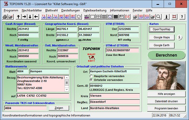
TOPOWIN is a state-wide register of the German Topographic Cartographies, the German Basic Cartography and of localities with geo references in different coordinate systems. It is also a topographic information system. In the division of planning and execution of economical and scientific projects frequently topographic documents are used. The program TOPOWIN makes information available of the official topographic cartographies and the German...
Read more
- Rate:
- Release Date:01/16/2017
- License:Shareware
- Category:Calendar Tools
- Developer:Killet Software Ing.-GbR
- Downloads:660
- Size:4.08 Mb
- Price: $125.00
To free download a trial version of TOPOWIN, click here
To buy software TOPOWIN, click here
To visit developer homepage of TOPOWIN, click here
Advertisement
Versions History
| Version | Date Released | Release Notes |
| 16.00 | 16.01.2017 | Digital signature for secure installation of the program. All map views supplemented with UTM edge coordinates. Program completely redesigned and functional supplemented. View of maps in OpenTopoMap, Google Maps, Google Earth. WINDOWS©10 certification after 32Bit / 64Bit intensive test. |
| 15.28 | 21.04.2016 | All map views supplemented with UTM edge coordinates. Program completely redesigned and functional supplemented. View of maps in OpenTopoMap, Google Maps, Google Earth. All databases actualized on 1st. January 2016. WINDOWS©10 certification after 32Bit / 64Bit intensive test. |
| 14.01 | 01.09.2015 | All databases actualized on 1st January 2015. 8100 new town quarters added. 34600 location coordinates changed with higher accuracy. Output of window contents in GIF and BMP files. Uses ANSI character set instead of ASCII. WIN8, WIN7 and WIN-Vista certification renewed. |
| 12.10 | 06.07.2013 | Datenstand aller Datenbanken auf den 1. Januar 2013 aktualisiert. Ausgabe der Fensterinhalte in GIF- und BMP-Dateien. Verwendet den ANSI-Zeichensatz anstelle von ASCII. WIN-Vista und WIN-7 Zertifizierung erneuert. Um 3500 Ortsteile auf ca. 119000 Datens |
| 11.21 | 04.02.2012 | More accurate coordinate transformations with new GeoDLL. Databases actualized on5th Sept. 2011 (Reform in Mecklenburg-Western Pomerania). WIN-7 and WIN-Vista certification renewed. Program fitted with a modern CHM help system. With 3.500 new town quarters amended on more than 119.000 data records. |
| 11.13 | 23.09.2011 | WIN-7 and WIN-Vista certification renewed. Databases actualized on data level 1th January 2011. Program fitted with a modern CHM help system. New addresses of the map supplier. With 3.500 new town quarters amended on more than 119.000 data records. |
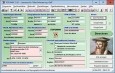
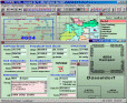
Screen Shot
Click on a thumbnail for the larger image.
System Requirements
TOPOWIN requires WinXP, WinVista, WinVista x64, Win7 x32, Win7 x64, Win2000, WinOther, WinServer, WinMobile, Windows 10, Windows 8.
TOPOWIN v.16.00 Copyright
Shareware Junction periodically updates pricing and software information of TOPOWIN v.16.00 full version from the publisher using pad file and submit from users. Software piracy is theft, Using crack, password, serial numbers, registration codes, key generators, cd key, hacks is illegal and prevent future development of TOPOWIN v.16.00 Edition. Download links are directly from our publisher sites. Links TOPOWIN v.16.00 from Bittorrent, mediafire.com, uploadfiles.com, hotfiles.com rapidshare.com, megaupload.com, netload.in, storage.to, depositfiles.com and other files hosting are not allowed. The download file is obtained directly from the publisher, not from any Peer to Peer file sharing applications such as Shareaza, Limewire, Kazaa, Imesh, eDonkey, eMule, Ares, BearShare, Overnet, Morpheus, BitTorrent Azureus and WinMX.
Review This Software
More TOPOWIN Software
TOPOWIN v.16.00
TOPOWIN is a state-wide register of the German topographic cartographies and of localities with geo references in different coordinate systems. It also is a topographic information system.
TOPOWIN English v.13.00
TOPOWIN is a state-wide register of the German topographic cartographies and of localities with geo references in different coordinate systems. It also is a topographic information system.
Other products of this developer Killet Software Ing.-GbR

DRAGSENS v.4.01
DRAGSENS Geo Software is used for the exact posi... estimation of the position of a dragged sensor.

Geodata Germany v.22.03
The database contain geodata of the Federal Repu...capes, climatic zones for proximity searches ec.

Geodata International v.10.05
Geodata International - World-wide database of c...ximity search, navigation, distance calculation.

GeoDLL v.18.24
GeoDLL is a Geodetic Development Kit / Geodetic ...rt, NTv2, HARN, INSPIRE, EPSG, DEM and much more

Graphics4VO DLL v.11.04
Graphics4VO is the graphics interface for the pr... the display, printer, plotter, file and memory.

ORTWIN v.13.02
ORTWIN is a program for the inquiry of localitie...capes, natural units, snow- and wind load zones.

SEVENPAR v.8.01
SEVENPAR calculaties exact parameter sets for th...eference systems for coordinate transformations.

TRANSDAT v.20.37
TRANSDAT Coordinate Conversion supports thousand...le systems and much more with highest accuracy.